|
|
Saffuriyya : Brief Informations
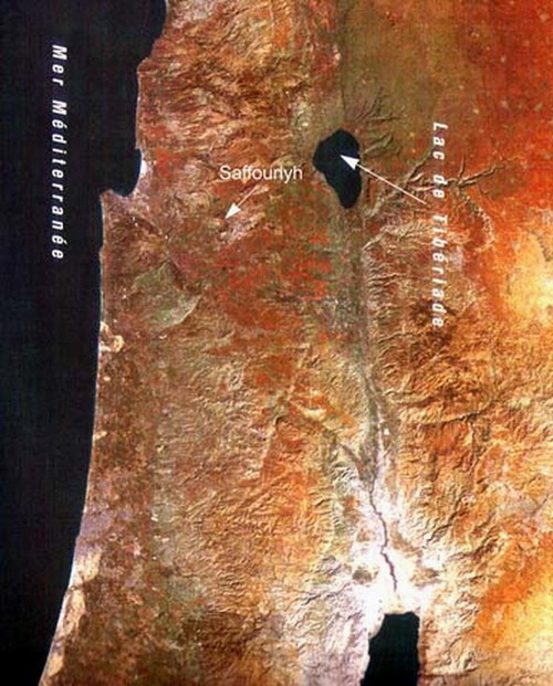
Israeli occupation date: July 16th, 1948 Place of village: 6 km Northwest of Nazareth Elevation from the sea: 250 (meters) Saffuriyya was mostly destroyed, and only few houses remained. The Jewish National Fund had planted pine trees over the village. Saffuriyya inhabitants were completely ethnically cleansed, they were exiled to Syria and Lebanon, however, some live as Palestinian-Israeli citizens in Nazareth. The Israelis don't permit to the Saffuriyyans to return to their land and rebuilt their houses. Population before occupation
Land ownership before occupation
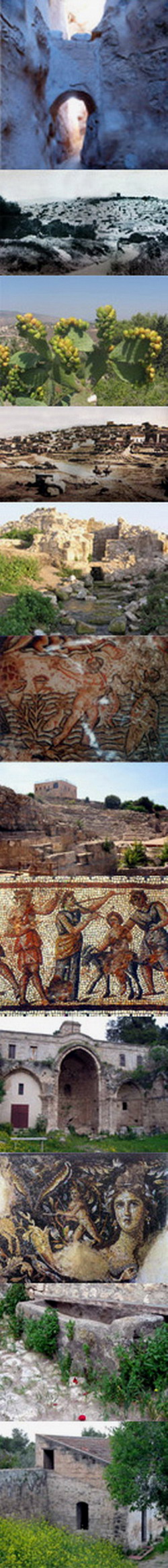
Number of houses: In (1931): 747 Village's name through history: The Romans referred to the village by Sepphoris, and the Crusades called it Le Sephorie. Schools: Saffuriyya had two elementary schools, one for boys and another for girls. Local council: A local council was established in 1923 to manage the local affair of the village. Water supplies: The village contains many springs, the most important is 'Ayn al-Qastal. Archeological sites:Saffuriyya contains a Roman coliseum, a fortress built by Crusades, and it also contains the remains of Saint Hanna Church. Israeli settlements on village lands: Tzippori, ha-Solelim, Allon ha-Galil Hosha'aya, and Chanton. |
|
|
|
|
|
|
|
|
|
|
|
|
![]()